


Zur Hauptnavigation Zum Hauptcontent

Geological Circular Hiking Trail Lorch

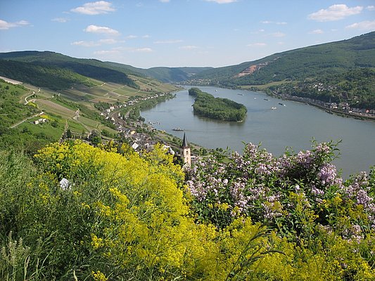
The wine town of Lorch on the Rhine is the westernmost municipality of Hesse. The origin of the partly still preserved town fortifications dates back to the 12th century. Due to dangerous rapids at the Binger Loch, Lorch was an important transshipment point for ship transports on the Rhine in the Middle Ages. Goods were unloaded at the harbor at the Wispermündung and transported further overland via the so-called merchants' path from Lorch to Rüdesheim and back. A short part of the Geological Circular Hiking Trail also leads along this historic path. The short circular route leads around the World Heritage vineyard created in 2010 on the heights above Lorch. Based on display panels and existing rock formations on site, the path opens interesting windows into geological and landscape developments in their relationship to culture and viticulture in the region. Artistically designed exhibits inform about geological eras and rocks of the Middle Rhine Valley. A part of the 1.2 km long route runs on the famous Rheinsteig, which leads above Lorch through the rock terraces of the Rhine valley. In the “World Heritage vineyard,” 550 Riesling vines grow, which were planted by vocational students as a volunteer work project as part of a teaching project. The project aims to inform about the special features of this vineyard and to raise awareness of the importance of the Rheingau cultural landscape in the Upper Middle Rhine Valley World Heritage area. The cultivation of the World Heritage vineyard and the wine production are done by Lorcher winemakers.

Opposite the monument at Römerberg (S), a path leads diagonally right between the cemetery wall and the slope above the cemetery into the World Heritage vineyard. The “Stickelbank” on the viewing platform at the World Heritage vineyard (1) already offers the chance to rest after a few hundred meters with a wonderful view over the Lorcher vineyard locations and into the Upper Middle Rhine Valley. From there, the path continues uphill through the vineyard until it meets the Rheinsteig at the top of the slope. Here sharply left, first past a geological exposure, then a second rest area with an installation of stone steles (2) invites you to take another break and engage with the rock types of the region. Directly below, the World Heritage logo is drawn into the slope with slate and lawn. Now the path slowly becomes a field path and leaves the vineyards. Between meadows and bushes, the edges of the path become steeper until the path turns sharply left at a slate rock and winds downhill back into the town and to the starting point at Römerberg.

The alleys in the town are narrow; if necessary, use parking spaces on Rheinuferstraße and walk via Schwalbacher Straße and Marktgasse to Römerberg.

Train station Lorch/Rhein, VIAS Rheingau line SE 10 between Koblenz Hbf and Wiesbaden Hbf.

www.rmv.de


Tourist Information Lorch am Rhein 
Hilchenhaus
65391 Lorch/Rhein 
Tel. 06726/18-15
tourismus@lorch-rhein.de, www.lorch-rhein.de

characteristics

easy
45 m
1,1 km
64.56 m
53.35 m


WIESBADEN RHEINGAU · : Wandermagazin